Please use this identifier to cite or link to this item: https://hdl.handle.net/20.500.12544/2133
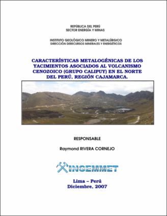
Características metalogénicas de los yacimientos asociados al volcanismo Cenozoico (Grupo Calipuy) en el Norte del Perú, región Cajamarca
Dec-2007
[ENG] The Direction of Mineral and Energy Resources of the INGEMMET carried out the study of the Metallogeny of the Cajamarca region. This area is located between the coordinates: 78º00' - 79º30' West longitude and 6º30' - 7º30' South. One filed trips were realized where 6 minerals deposits were recognized: Minas Conga (Chailhuagón and El Perol), El Galeno, Hilorico, Sartenes, and Paredones. During the field work geologic structures, litology, units, hydrothermal alterations were recognized. 36 samples of between ore and hosted rocks were collected for microscopy studies, and geochemical analysis. Wilson, J. (2000) establishes that our study area is inside a great sedimentary basin (Cuenca Cajamarca), where were deposited generally sediments of the Jurassic superior and of the Cretaceous. who later were overlay for the magmatism of the Cenozoic. The mineralization in the metallogenic belts was controlled by 2 clear systems of regional fault: Punre-Canchis and Quesquenda fault system, each one of these controls has an characteristic orientation (NW and E-W respectively), both systems of fault are associated to the deflection of Cajamarca. According to the geotectonic domains and the litology contacts were defined 5 metallogenic belts: Cu-Mo Porphyries of the Upper Cretaceous - Paleocene, Cu-Mo-Au porphyry-Skarn of the middle Miocene, High sulphidation epithermal hosted in volcanic rocks, High sulphidation epithermal hosted in sedimentary rocks and Low sulphidation epithermal hosted volcanic rocks, all them of the Upper Miocene.
[ESP] La Dirección de Recursos Minerales y Energéticos del INGEMMET realizó el estudio de la Metalogenia de la región Cajamarca. Esta área está localizada entre las coordenadas: 78º00’ - 79º30’ de longitud Oeste y 6º30’ - 7º30’ de latitud Sur. Se realizó una salida de campo donde se reconocieron 6 depósitos de minerales: Minas Conga (Chailhuagón y el Perol), El galeno, Hilorico, Sartenes, y Paredones. Se reconocieron estructuras geológicas, litologías, alteraciones hidrotermales y se recolectaron 36 muestras entre mena y rocas hospedantes para estudios de microscopia, y análisis geoquímicas. Wilson, (2000) establece que nuestra zona de estudio se encuentra dentro de una gran cuenca sedimentaria (Cuenca Cajamarca), donde se depositaron por lo general sedimentos del Jurásico superior y del Cretáceo, quienes posteriormente fueron sobreyacidos por el magmatismo del Cenozico. La mineralización en las franjas metalogenéticas está controlada por 2 claros sistemas de fallas regionales: Sistema de fallas Punre-Canchis y el sistema de fallas Quesquenda, cada uno de estos controles tiene una orientación característica (NW y E-W respectivamente), ambos sistemas de fallas se encuentran asociados a la deflexión de Cajamarca. Según los dominios geotectónicos y los contactos litológicoss se definieron 5 franjas metalogenéticas: Pórfidos de Cu-Mo del Cretáceo superior – Paleoceno, pórfidos-Skarn de Cu-Mo-Au del Mioceno medio, epitermales de alta sulfuración emplazados en rocas volcánicas, epitermales de alta sulfuración emplazados en rocas sedimentarias y epitermales de baja sulfuración emplazados en rocas volcánicas, todos ellos del Mioceno superior.
Instituto Geológico, Minero y Metalúrgico - INGEMMET
82 páginas.

Files in This Item:
File Description SizeFormat 
2007-Rivera-Características_metalogenicas _ yacimientos_ norte_Peru.pdfEstudio11.17 MBAdobe PDFView/Open


This item is licensed under a Creative Commons License Creative Commons