Please use this identifier to cite or link to this item: https://hdl.handle.net/20.500.12544/2394
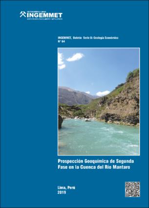
Prospección geoquímica de segunda fase en la cuenca del río Mantaro - [Boletín B 64]
Oct-2019
INGEMMET, Boletín Serie B: Geología Económica;n° 64
[ENG] The Directorate of Mineral and Energy Resources of the INGEMMET developed during 2016, the second phase geochemical prospecting in part of the Mantaro River basin, covering the departments of Huancavelica, Junín, Pasco and Ayacucho, along a 12410 km2. The studied area includes the sub-basins Huarpa, Ichu, Vilca Moya, Cunas, Pariahuanca, Shullcas, Achamayo, Quisualcancha, Huari, Yauli, Atoc Huarco, Conocancha, Santa Ana and San Juan; the elevations in the area have a range of 1550 m s.n.m to 5200 m s.n.m. Thus, there are different types of climate, from very rainy-warm-very humid to rainy-cold-humid. In the study area, the lithostratigraphic units have ages from the Neoproterozoic to the Quaternary and the oldest are the metamorphic rocks of the Marañón Complex. The series between the Mississipian and Oligocene are represented mainly by sedimentary units, whereas during the Miocene-Pliocene there is a predominance of volcanic sequences. As for intrusive rocks, these define ages ranging from the Carboniferous to the Pliocene. The regional fault systems in the study area are the following: La Oroya-Huancavelica, Ayacucho-Cerro de Pasco, Huaytará and Abancay-Andahuaylas-Toto. Most of them with NO-SE orientation. In addition, based on the different tectonic and magmatic events, four structural units were determinate related to tectonic of the phases Neoproterozoic, Hercínica, Andina and intrusive Permian-Triassic rocks. The metalogenetic context indicates the existence of favorable environments for the placement of gold deposits in meta-sedimentary rocks of the Ordovician and Silurian-Devonian, porphyry and skarns of base metals, as well as gold and silver epithermal and polymetallic deposits. The present study comprised the systematic sampling of current sediments in 643 sampling stations. These sediments were sieved using the No. 200 mesh and then analyzed by ICP-MS, for multi-elemental quantification the sediments was digested by aqua regia method. The gold concentrations were determined through the fire assay and the atomic absorption spectroscopy. The combination of these analytical techniques allowed results of 53 chemical elements. At each sampling station, in situ readings of pH and electrical conductivity were taken. Based on these readings, the pH range of the surface waters was determined from 5.43 to 12.92, the 98% of the readings has basic pH (greater than 7). Additionally, 643 sampling stations were established and 106 of them had no runoff during field data collection. The electrical conductivity showed a range of 2 µS/cm to 13900 μS/cm, 76% of the readings were less than 500 μS/cm, with an average of 228 μS/cm. As well as seven sampling stations had conductivities greater than 1500 μS/cm, these define a range of 1658 μS/cm to 13900 μS/cm. The distribution and main geochemical anomalies of As, Cu, Cr, Hg, Mo, Ni, Au, Ag, Pb and Zn are detailed and explained for each environment or lithostratigraphic domain, these are 386 in total. From the evaluation of the metallogenetic context, spectral anomalies, geochemical anomalies and the state of the mining cadastre, were proposed four areas of interest: Secclla, Río Seco, Tauribamba and San Antonio, in that order of priority. In these areas, highlight anomalies of Pb-Zn-Mo-As-Ni, Pb-Ag-As, Cu-Zn-Cr-Ni and Cu-Zn-Ni. 
Instituto Geológico, Minero y Metalúrgico - INGEMMET
Vargas, L.; Pérez, V.; De La Cruz, C; Pascual, O.; Lazo, J., et al. (2019). Prospección geoquímica de segunda fase en la cuenca del río Mantaro. INGEMMET, Boletín, Serie B: Geología económica, 64, 313 p., 16 mapas.
313 páginas, 16 mapas.

Files in This Item:
File Description SizeFormat 
B-064-Prospeccion_geoquimica_cuenca_rio_Mantaro.pdfBoletín INGEMMET Serie B, n° 6436.16 MBAdobe PDFView/Open
B064-MAF-GE36_3-16-01.pdfMapa Anomalías espectrales20.29 MBAdobe PDFView/Open
B064-MAF-GE36_3-16-02.pdfMapa Ubicación de muestras de sedimento del sector norte5.12 MBAdobe PDFView/Open
B064-MAF-GE36_3-16-03.pdfMapa Ubicación de muestras de sedimento del sector centro9.58 MBAdobe PDFView/Open
B064-MAF-GE36_3-16-04.pdfMapa Ubicación de muestras de sedimento del sector sur10.23 MBAdobe PDFView/Open
B064-MAF-GE36_3-16-05.pdfMapa Distribución del potencial de hidrógeno en estaciones de muestreo22.68 MBAdobe PDFView/Open
B064-MAF-GE36_3-16-06.pdfMapa Distribución de la conductividad eléctrica en estaciones de muestreo22.75 MBAdobe PDFView/Open
B064-MAF-GE36_3-16-07.pdfMapa Dispersión geoquímica secundaria de As21.82 MBAdobe PDFView/Open
B064-MAF-GE36_3-16-08.pdfMapa Dispersión geoquímica secundaria de Cu11.08 MBAdobe PDFView/Open
B064-MAF-GE36_3-16-09.pdfMapa Dispersión geoquímica secundaria de Cr10 MBAdobe PDFView/Open
B064-MAF-GE36_3-16-10.pdfMapa Dispersión geoquímica secundaria de Hg21.79 MBAdobe PDFView/Open
B064-MAF-GE36_3-16-11.pdfMapa Dispersión geoquímica secundaria de Mo21.79 MBAdobe PDFView/Open
B064-MAF-GE36_3-16-12.pdfMapa Dispersión geoquímica secundaria de Ni10.02 MBAdobe PDFView/Open
B064-MAF-GE36_3-16-13.pdfMapa Dispersión geoquímica secundaria de Au10.03 MBAdobe PDFView/Open
B064-MAF-GE36_3-16-14.pdfMapa Dispersión geoquímica secundaria de Ag10.02 MBAdobe PDFView/Open
B064-MAF-GE36_3-16-15.pdfMapa Dispersión geoquímica secundaria de Pb9.5 MBAdobe PDFView/Open
B064-MAF-GE36_3-16-16.pdfMapa Dispersión geoquímica secundaria de Zn9.51 MBAdobe PDFView/Open


This item is licensed under a Creative Commons License Creative Commons