Please use this identifier to cite or link to this item: https://hdl.handle.net/20.500.12544/2479
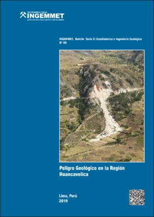
Peligro geológico en la región Huancavelica - [Boletín C 69]
Dec-2019
INGEMMET, Boletín Serie C: Geodinámica e Ingeniería Geológica;n° 69
The Huancavelica region, located in the central highlands of Peru; it occupies zones comprised between the Western Cordillera, inter-Andean valleys and the Eastern Cordillera. It extends from altitudes ranging from 1 000 m.a.s.l. to above 5 000 m.a.s.l. in the Western Cordillera; geographically its coordinates are located between 11º 16 ‘10’ ‘and 14º 07’ 43 ‘’ of latitude south and 74º 16 ‘and 75º 47’ of west longitude of the meridian of Greenwich. It ha a territorial extension of 22 131 km², equivalent to 1,73% of the national territory. As a result of this study of geological hazards, the inventory and mapping of dangers at a scale of 1: 50,000 was obtained, for this purpose high-resolution satellite image interpretation work and aerial photographs of the years 1962 and 1963 were carried out. 1740 occurrences of hazards were identified, of which the greatest occurrences are fall, followed by debris flows (huaicos), landslides, slope erosion processes, complex movements, erosion and fluvial flooding. The study identified 45 critical zones related to geological hazards (by mass movements) and geohydrological (flood and fluvial erosion), among which are: the Mantaro river valley, critical in several sectors; The highway stretches Sachapite-Huancavelica, Manta-Moya, Acostambo-Izcuchaca, Tambillo-Huando-Yanaccollpa, Yauli-Huancavelica, central road its stretch between Quichuas and Mayoc; the sectors of Pilchaca, Acoria, Huancavelica-Ascensión, Palca, Yauli, Pampas, Casay, Porvenir Alto, Corinto, Carampa, Acollascca and Marcayllo, Chonta, Huaribamba, Cuenca and Mayoc. Finally, the thematic maps presented and elaborated with the help of geographic information systems (GIS), are important as a prevention tool, because they provide an important basis for planning, which contribute to solving the problem of geological hazards in the region.
Instituto Geológico, Minero y Metalúrgico - INGEMMET
Vilchez, M.; Ochoa, M. & Pari, W. (2019). Peligro geológico en la región Huancavelica. INGEMMET, Boletín, Serie C: Geodinámica e Ingeniería Geológica, 69, 225 p., 9 mapas.
225 páginas, 9 mapas.

Files in This Item:
File Description SizeFormat 
C069-Boletín_Peligro_geológico_Huancavelica.pdfBoletín Ingemmet C-6982.16 MBAdobe PDFView/Open
C069-Mapa_1_Cobertura vegetal.pdfMapa cobertura vegetal20.15 MBAdobe PDFView/Open
C069-Mapa_2_Litológico.pdfMapa litológico25.08 MBAdobe PDFView/Open
C069-Mapa_3_hidrogeológico.pdfMapa hidrogeológico18.3 MBAdobe PDFView/Open
C069-Mapa_4_pendientes.pdfMapa de pendientes9.32 MBAdobe PDFView/Open
C069-Mapa_5_geomorfológico.pdfMapa geomorfológico20.55 MBAdobe PDFView/Open
C069-Mapa_6_inventario_de_peligros.pdfMapa de inventario de peligros18.3 MBAdobe PDFView/Open
C069-Mapa_7_susceptibilidad_mm.pdfMapa de susceptibilidad mm23.71 MBAdobe PDFView/Open
C069-Mapa_8_susceptibilidad_ief.pdfMapa de susceptibilidad ief22.3 MBAdobe PDFView/Open
C069-Mapa_9_zonas_criticas.pdfMapa de zonas críticas8.64 MBAdobe PDFView/Open


This item is licensed under a Creative Commons License Creative Commons