Please use this identifier to cite or link to this item:
https://hdl.handle.net/20.500.12544/4933Analyses of Landsat thematic mapper images of study areas located in western of study áreas located in western Bolivia, northern Chile, and Southern Peru
Mar-1993
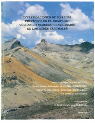
Investigaciones de metales preciosos en el complejo volcánico Neógeno-Cuaternario de los Andes Centrales
Landsat Thematic Mapper (TM) images were analyzed to identify volcanic and structural features and hydrothermally altered rocks in the Neogene-Quaternary volcanic field near Berenguela, western Bolivia, Esperanza, in the Maricurga district of northern Chile, and in the vicinity of the Orcopampa mine in 1 southem Peru. These areas were being investigated for the presence of epithermal precious-metal deposits. Four TM image quadrants were processed for each country, and the resulting enhanced black-and-white single-band images, false-color composite (FCC) images, and color-ratio composite 1 (CRC) images were printed at either 1:200,000- or 1:250,000-scale. In addition, a selected CRC image, which was designed for delineating hydrothermally altered rocks, was printed at 1:50,000-scale. A correction for atmospheric scattering was applied to most images, and snow and water were eliminated 1 from the data using digital masking techniques. Initial field evaluation of the 1:50,000-scale images of the Berenguela, Bolivia and Esperanza, Chile study areas indicated that the main areas of hydrothermally altcred rocks were readily identified, bue sorne important distinctions between altered and unaltcred rocks, and subdivisions of these two broad roups, were not evident. Based on the field observations and subsequent spectral reílectance laboratory measurements of the main rock types, improved 1:50,000-scale CRC images were produced. For the Berengucla CRC image the most important modification to the initial TM 5/7, 3/1, 4/3 image was the application of a digital mask for vegetation, which covers 30 to 40 percent of the surface. Use of the vegetation mask permitted replacement of the TM 4/3 ratio, which is responsive to vegetation, with mother ratio that provided improved lilhologic discrimination. In addition, spectral reflectance studies howed that the TM 5/1 ratio was prefcrable to the TM 3/1 ratio far displaying fe+3 absorption effects. The TM 5/7 ratio is sensitive to Al-OH absorption in alteration minerals, such as alunite and kaolinite, and Fe-OH absorption in jarosite. Five large areas consisting of hydrothermally altered rocks wcre delineated. Four of these arcas are mineralized, and two areas had not been mapped previously. Also, numerous small scattered anomalous areas were delineated in the sand5tone of Bcrenguela near the village of Berenguela. The presence of jarosite in sorne samples indicares that the sand-,tone contains, at least locally, the mineralized effccts of hydrothermal altcration, but sorne of the CRC image anomalies may be caused by calcite and kaolinitc related to diagcnesis and/or weathering. In the Esperanza study area interpretation of the TM 5/7, 5/1, and 5/4 1:50,000-scale CRC image was facilitated by producing a four-level pseudocolor density-sliccd image of the TM 5/7 ratio and merging it with a black-and-white TM band 4 image. Analysis of rellectance spectra of samples collected within the four levels was uscd to determine the digital number boundaries. The results indicate that the density levels reflect differences in hydrochermal alteration intensity, which aidcd in elimination of false anomalies in the fmal map. Several previously unmapped arcas consisting of hydrothermally altered rocks were identified. The authors did not conduct field studies in southern Perú. I-Iowever, the spatial distribution of probable hydrothermally altered rocks in the TM 5/7, 3/1, and 4/3 CRC image of the Orcopampa mine area is similar to that shown in an unpublished mine map, suggesling that the numerous anomalies shown on other parts of the Pení CRC image may also represent hydrothcrmally altered rocks.
Servicio Geológico de Bolivia (GEOBOL)
Eiswerth, B. (1993). Analyses of Landsat thematic mapper images of study áreas located in western of study áreas located in western Bolivia, northern Chile, and Southern Peru. En: Servicio Geológico de Bolivia, Servicio Nacional de Geología y Minería, Chile, Instituto Geológico Minero y Metalúrgico, Perú & U.S Geological Survey, Investigaciones de metales preciosos en el complejo volcánico Neógeno-Cuaternario de los Andes Centrales. La Paz: Servicio Geológico de Bolivia, pp. 19-44.
26 páginas
Files in This Item:
| File | Description | Size | Format | |
|---|---|---|---|---|
| Eiswerth-Analyses_Landsat_thematic.pdf | 27.74 MB | Adobe PDF | View/Open |
This item is licensed under a Creative Commons License


