Showing results 1738 to 1757 of 1837
< previous
next >
| Preview | Issue Date | Title | Author(s) |
 | 1983-09 | Report on geological survey of Iscaycruz (Oyon) area: Phase I | Japan International Cooperation Agency |
 | 1984-05 | Report on geological survey of Iscaycruz (Oyon) area: Phase II | Japan International Cooperation Agency |
 | 1985-09 | Report on geological survey of Iscaycruz (Oyon) area: Phase III | Japan International Cooperation Agency |
 | 1985-09 | Report on mineral exploration in Iscaycruz (Oyon) area: consolidated report | Japan International Cooperation Agency |
 | 1986-03 | Report on mining development plan of Iscaycruz (Oyon) area | Japan International Cooperation Agency |
 | 1986-03 | Report on mining development plan of Iscaycruz (Oyon) area: report of metallurgical investigation | Japan International Cooperation Agency |
 | 2002-03 | Report on research and development of remote sensing technology for non-renewable resources. The study of applied aster data techniques for the determination of the geological settings forming a skarn type ore deposit (Central Area de la Republic of Peru) | Instituto Geológico Minero y Metalúrgico del Perú; Mitsui Mining & Smelting Co. |
 | 1999-03 | Report on the geological survey in the Urubamba river inferior area of the Republic of Peru (Phase I) | Japan International Cooperation Agency |
 | 1977 | Report on the geological survey in the Urubamba river inferior area of the Republic of Peru. Final Report | Japan International Cooperation Agency |
 | 1996 | Reporte de análisis químico de los cuadrángulos Macusani, Sandia, Limbani, Nunoa, San Ignacio y del proyecto aurífero Mima | Instituto Geológico Minero y Metalúrgico |
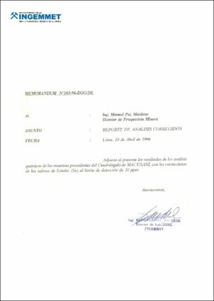 | 1996-04 | Reporte de análisis químicos corregidos del cuadrángulo Macusani | Instituto Geológico Minero y Metalúrgico. Dirección de Laboratorio |
 | 2024-04 | Reporte de monitoreo del deslizamiento de Alto Siguas, periodo 2022 - 2023. Distritos Majes y San Juan de Siguas, provincias Caylloma y Arequipa, departamento Arequipa | Instituto Geológico Minero y Metalúrgico. Dirección de Geología Ambiental y Riesgo Geológico |
 | 2024-04 | Reporte de monitoreo del deslizamiento de Cuyo Chico, periodo 2021 - 2023. Distrito Pisac, provincia Calca, departamento Cusco | Instituto Geológico Minero y Metalúrgico. Dirección de Geología Ambiental y Riesgo Geológico |
 | 2024-04 | Reporte de monitoreo del deslizamiento de Higosbamba, Hichabamba, Huayllabamba y Churucana (Cajabamba), periodo 2022 - 2023. Distrito y provincia Cajabamba, departamento Cajamarca | Instituto Geológico Minero y Metalúrgico. Dirección de Geología Ambiental y Riesgo Geológico |
 | 2022-07 | Reporte de monitoreo del deslizamiento de Lucre periodo 2018 - 2021, distrito Lucre, provincia Quispicanchi, departamento Cusco | Instituto Geológico Minero y Metalúrgico. Dirección de Geología Ambiental y Riesgo Geológico |
 | 2024-04 | Reporte de monitoreo del deslizamiento de Maca, periodo 2022 - 2023. Distrito Maca, provincia Caylloma, departamento Arequipa | Instituto Geológico Minero y Metalúrgico. Dirección de Geología Ambiental y Riesgo Geológico |
 | 2022-12 | Reporte de monitoreo del deslizamiento de Punillo a diciembre 2022. Distritos La Joya y Vítor, provincia Arequipa, departamento Arequipa | Instituto Geológico Minero y Metalúrgico. Dirección de Geología Ambiental y Riesgo Geológico |
 | 2014-03 | Reporte de zonas críticas por peligros geológicos y geo-hidrológicos en la cuenca del río Lurín | Villacorta Chambi, Sandra Paula; Rosado Seminario, Malena; Núñez Juárez, Segundo |
 | 2003-10 | Reporte Geofísico Ingemmet : Proyecto A.N.A.D. Limamayo, departamento de Cuzco, Perú | VDG del Perú |
 | 2005-12 | Reporte preliminar de zonas críticas en la cuenca Chancay- Lambayeque. Departamentos de Lambayeque y Cajamarca | Núñez Juárez, Segundo; Villacorta Chambi, Sandra Paula |


